By Lisa Vives, Global Information Network
NEW YORK (IDN) — Saint-Louis, the old colonial capital of Senegal, was built in the 17th century at the mouth of the Senegal River and was the capital of French West Africa until 1902. But these days rising sea levels have created a flooding threat that has already seen entire villages lost to the Atlantic.
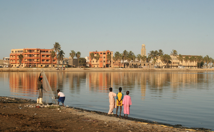
Guet Ndar, a district of Saint-Louis, is a UNESCO World Heritage site. Mosques, homes and a school there have already been lost to coastal erosion.
In 2003, the authorities dug a channel through the Langue de Barbarie, a thin, sandy strip of land protecting Saint-Louis, so water could flow out of the estuary and away from Saint-Louis when the Senegal River threatened to flood.
But their bid to protect the city backfired. Water flowed both ways, eroding the banks of the channel until it opened into a huge gulf, taking 800 meters of the Guet Ndar beach, as well as neighboring villages, with it.
It also upset the delicate balance of the local ecosystem. The canal brought seawater into the river and has affected the population of rare bird species and river fish. Coconut trees and mangroves that once protected the shores have been wiped out.
Ahmet Sene Diagne used to live in one such village. He recalls how he went to the town hall to warn against excavating the channel, but officials didn’t listen. Now, all that can be seen of Diagne’s village is the stump of a tree that once stood in the central square—the tree that Diagne got married under.
Latyr Fall, deputy mayor of Saint-Louis, recalls the old seawall that once protected his city. But the threat to “the Venice of Africa” is from climate change, he insists—and the sea level rise since colonial times calls for new measures to protect the coast. “The wall no longer protects us.”
The World Bank allotted $27 million to combat the effects of climate change in Saint-Louis. It estimates that 10,000 people in the city are either already displaced or live within 20 metres of the waterline, the high-risk zone.
By 2080, according to a study commissioned by the Senegalese government, 80% of Saint-Louis territory will be at risk of flooding by 2080 and 150,000 people will have to relocate.
Saint-Louis has “already been wiped off the map,” said Boubou Aldiouma Sy, a geography professor at the city’s Gaston Berger University.
Meanwhile, Ahmet Sene Diagne now lives in a settlement called Jel Mbaam, where he grows and sells his own produce. On the wall of his home, hangs a map showing where his village used to be before it was submerged.
He still doesn’t trust the authorities to protect the coast. “They should involve the people from here in their plans because we are the ones who live here, and were born from this water,” he says. [IDN-InDepthNews – 22 November 2021]
Photo: The Island of Saint-Louis, a UNESCO World Heritage site. Credit: CC BY 3.0


